My Semester Working on Mapping the Gay Guides
This is a guest post by Jillian Dillard, a graduating senior at Clemson University. Over the course of the Spring 2022 semester, Jillian worked with Dr. Regan to transcribe and geolocate data for Canadian entries in the Bob Damron Address Books. Here, she reflects on her experience working on a digital history project and shares some of the things she learned while working on the project.
My experience working on Mapping the Gay Guides has been my first in depth experience working on a digital history project. I specifically worked on transcribing the international locations in the Damron Guides from 1965-1977 to show international trends of gay communities. I worked specifically with the Canadian data. In 1965 there were 32 entries. That number grew to 261 entries in 1977. However, with an increase of locations that were seen as safe spaces for the gay community there was also an increase in Cruisy areas. In 1965 there were zero cruisy areas and by 1977 there were 80.
An interesting observation I made as I went through the guides was beginning in 1974 the Damron Guides began advertising the Swingers Overseas Gay Guide which included Europe, Morocco, Puerto Rico, and Mexico. This was interesting to me because at the time the Damron Guides were not giving locations in these areas however they were beginning to offer a way for people to still be able to find places they could feel comfortable in these areas.
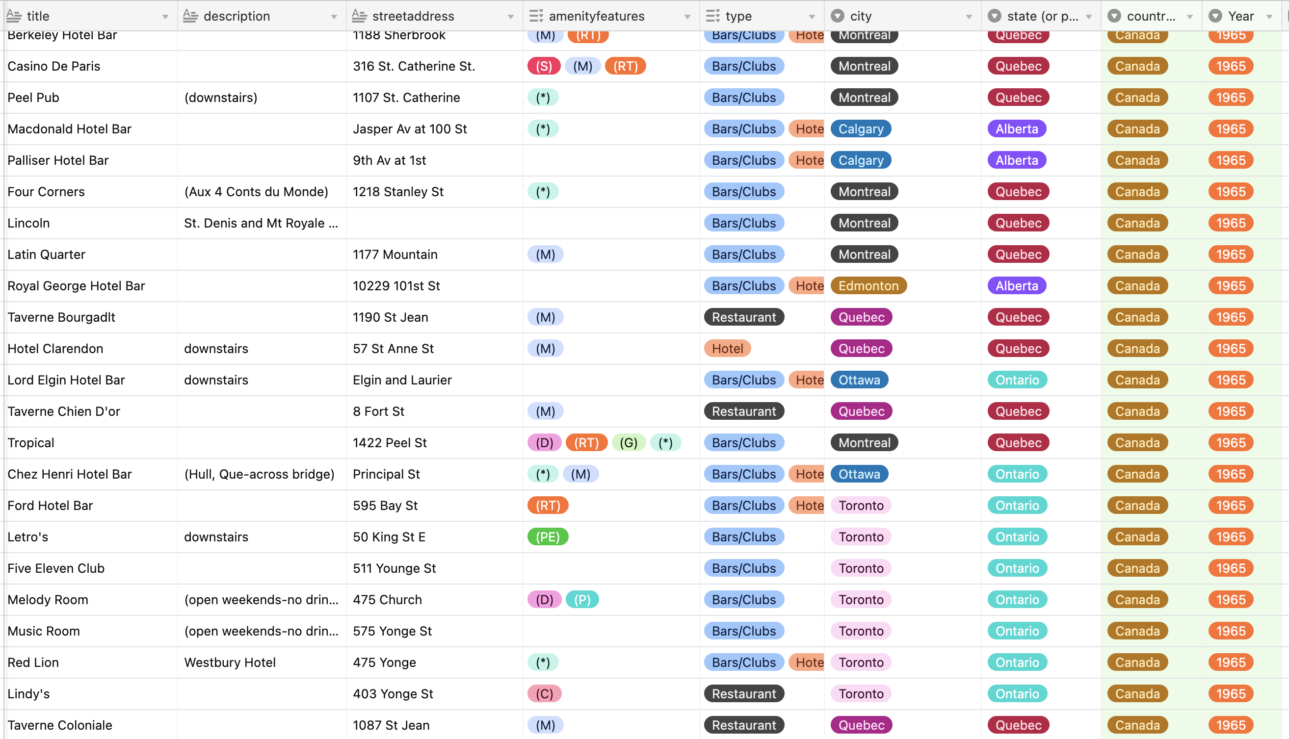
My work with MGG began with transcription. During this stage I transferred information from the guides to our collaborative space (which can be seen below).
During this process there was a lot of repetition from year to year with many of the same bars, clubs, and restaurants being in every guide. A trend I noticed over time was a growth in entries in bigger cities like Toronto and Montreal as well as the addition of locations in cities like St. Catherines, Ontario which did not have any locations until 1975.
As I transcribed, I also had to specify if certain locations had unclear addresses. These locations were moved into a separate table so their locations could be found. I specifically worked with unclear addresses from Toronto, Ontario which can be seen compiled on the map below.
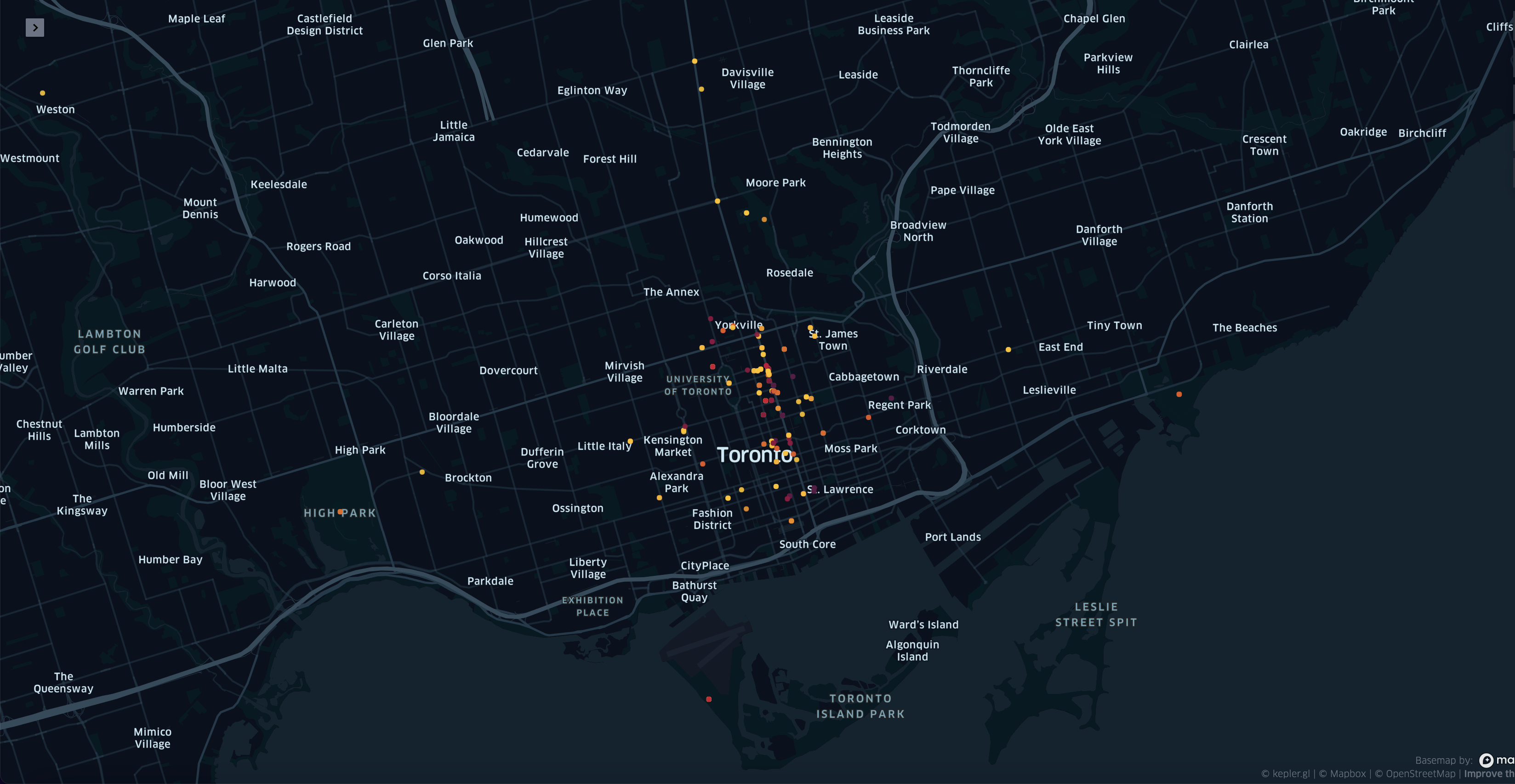
Initially when I began working on unclear addresses, I thought there would not be very many I would mark as general, however, I found this to be more common than I assumed. This was usually because of the vagueness of the entry, but in some cases because no information could be found about the locations. I also found that the majority of unclear addresses were also marked as Cruisy Areas.
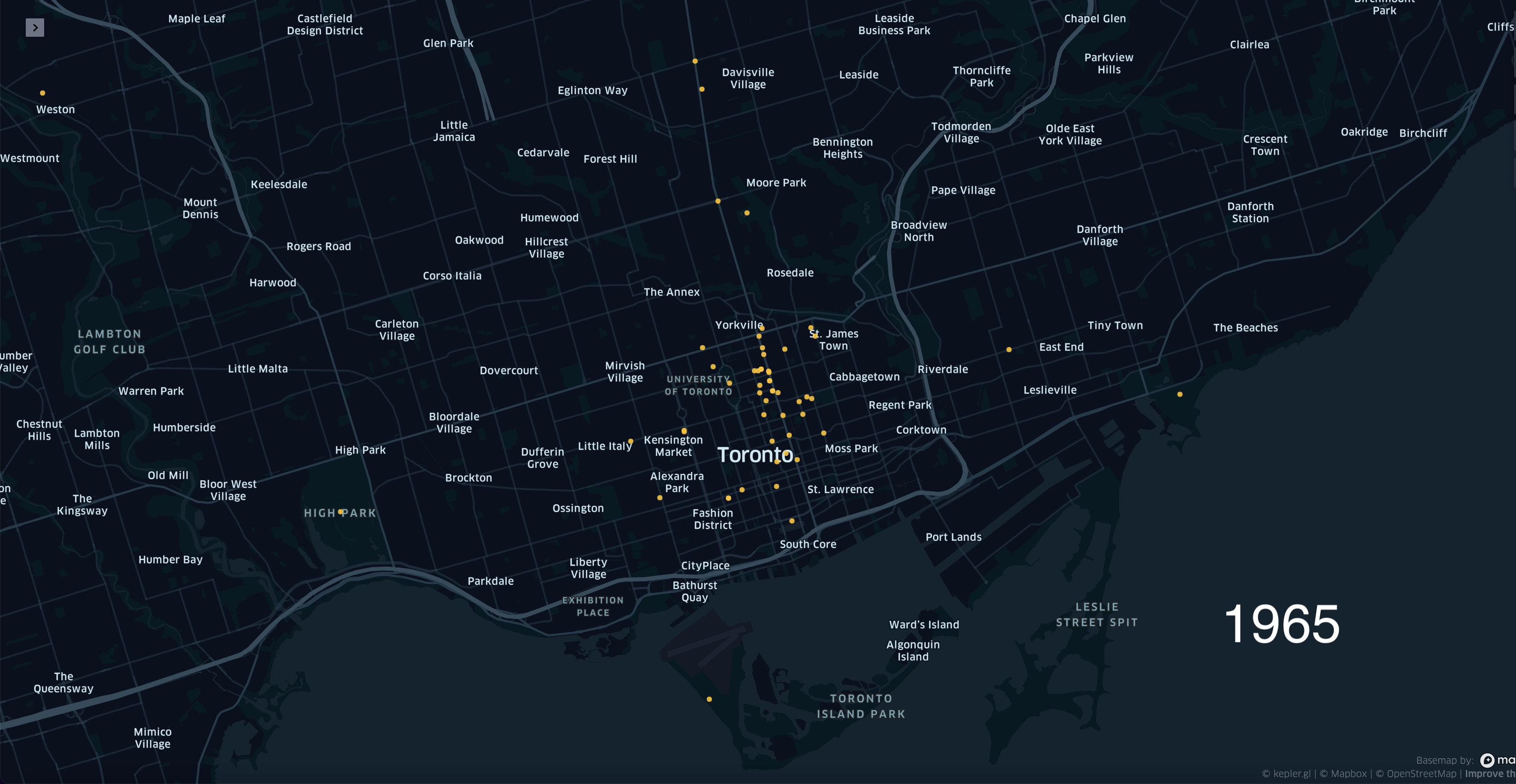
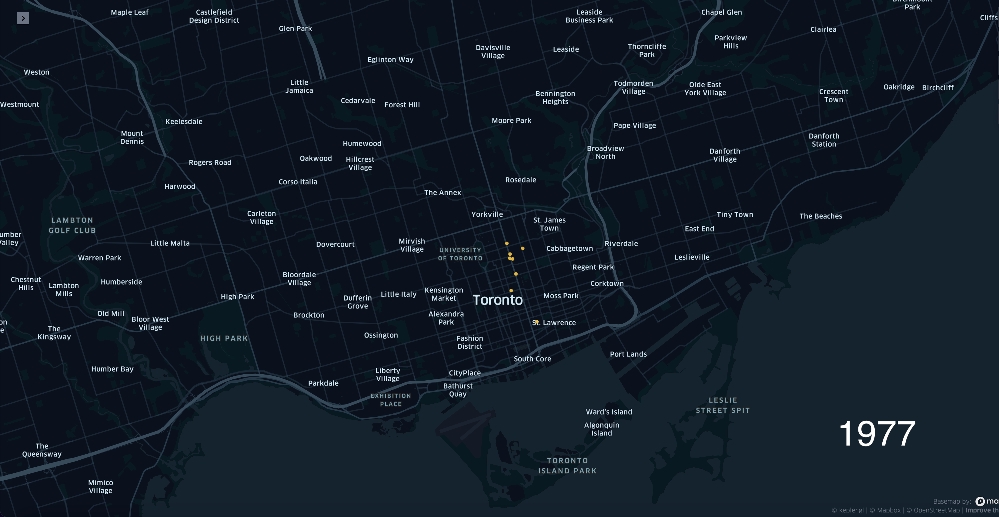
This research gave me an eye into how the gay scene was able to grow in Toronto and where it was growing. In 1965 there was a very small gay community beginning to grow in the Yonge Street area of Toronto and as we move into the 1970s, we can see the community growing along Yonge Street, into the Church Street area, and beginning to spot on Bay St. Transferring the information onto the map made this easier to visualize especially when the year is specified and you can watch the growth happen over time.
Comparatively to other things I have done during my time at Clemson University this project has been very different. Other projects I have studied or worked on have had me looking at Clemson or South Carolina locally and seeing trends displayed within the larger community. This project had me looking into the gay community in Canada specifically and then more specifically the gay community in Toronto. I was able to see growth more clearly as well as seeing what was popular. Being able to properly see these trends through work I have done on my own and not just through a lecture has been a great experience.
Jillian Dillard graduated from Clemson University in May 2022 with a BA in History with an Emphasis in Public History and a minor in Communication Studies. She plans to continue her education at George Washington University in the MA Museum Studies program with a track in Exhibitions and Visitor Experience in the Fall of 2022.