Announcing the Launch of Mapping the Gay Guides!
Today we’re excited to officially launch the first phase of Mapping the Gay Guides.
What is Mapping the Gay Guides?
Mapping the Gay Guides (MGG) is a digital mapping project that aims to understand often ignored queer geographies using the Damron Address Books, an early but longstanding travel guide aimed at gay men since the early 1960s. Similar in function to the green books used by African Americans during the Jim Crow era to help identity businesses that catered to black clients in the South, the Damron Guides aided a generation of queer people to identity sites of community, pleasure, and politics. By associating geographical coordinates with each location mentioned within the Damron Guides, MGG provides an interface for visualizing the growth of queer spaces between 1965 and 1980.
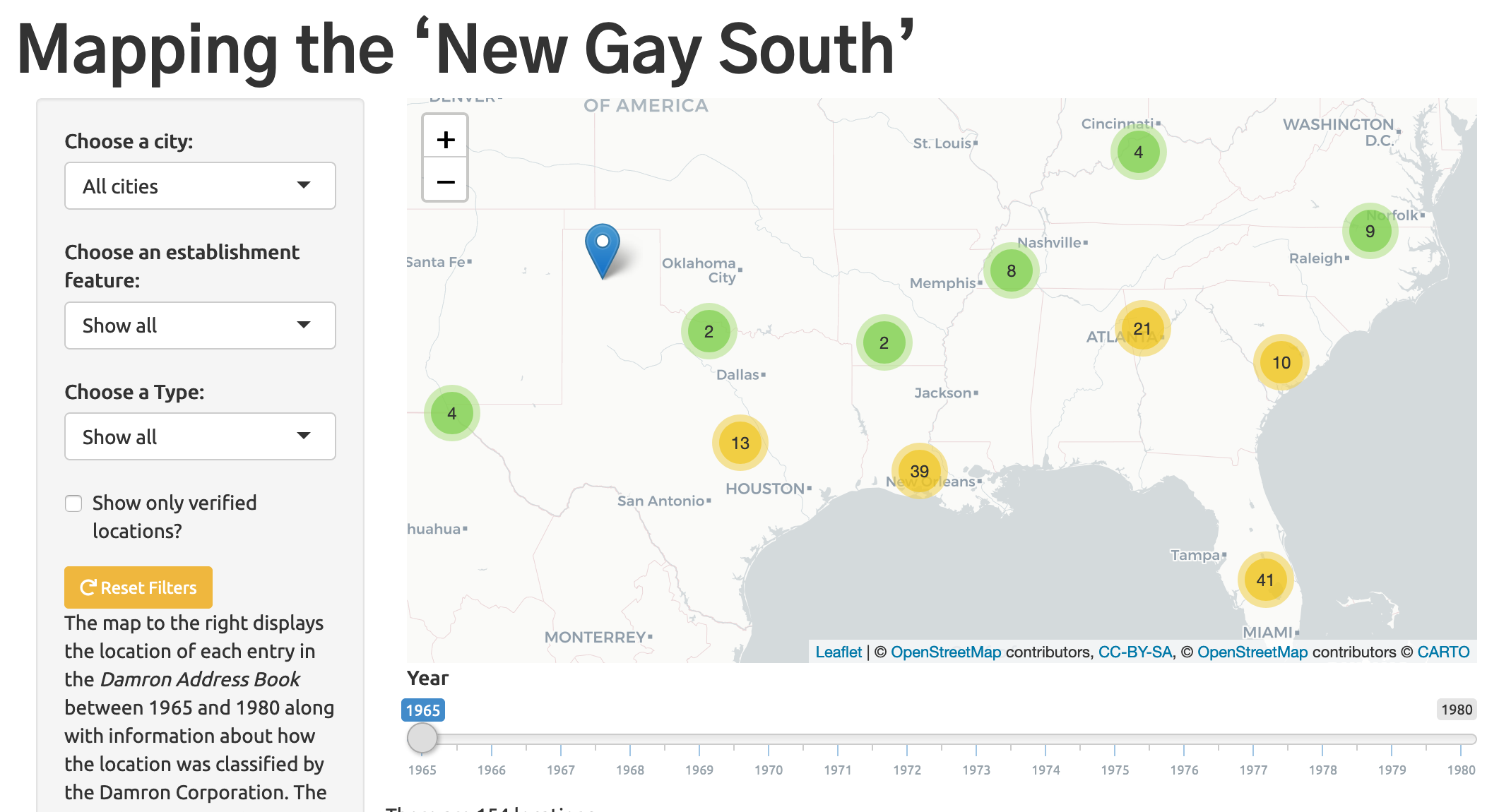
MGG’s first phase is focused on the American South. Over the last year we have constructed a data set based on all of the locations listed in the Damron Address Book for the following 12 states: Alabama, Arkansas, Florida, Georgia, Kentucky, Louisiana, Mississippi, North Carolina, South Carolina, Tennessee, Texas, and Virginia. Spanning twelve states and fourteen years this data provides a detailed portrait of gay life in the American South.
Why the Damron Address Books?
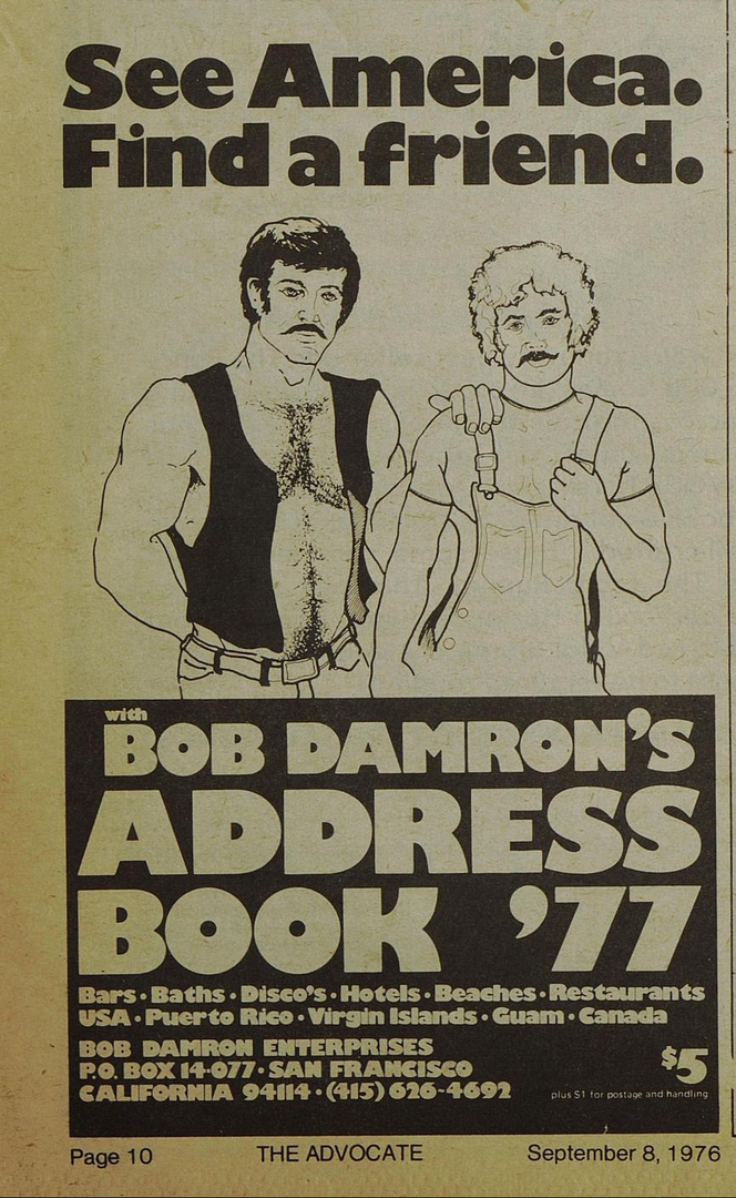
Advertisement for the 1977 edition of Bob Damron's Address Book.
While the Damron Address Books were not the only gay travel guide or yellow page in the 1970s, they were the original and remained the gold standard, especially for men, through the 1990s. Aside from being the most popular travel guide, its the nature of the data inside that makes these guides an ideal source for a digital project such as this. An entry in Damron’s guide typically included the name of the establishment, an address, sometimes notes or warnings, and often an “Explanation of Listings” which were lettered designations describing Damron’s own characterization of the location. For example, a location may contain a “(D)” next to it indicating that it was a popular location for Dancing.
These categorizations pose interesting historical questions. How did Damron’s perspective of certain regions of the country shape his categorization? How do these categorizations change over time, especially in the post-Stonewall period? Are spaces in the South categorized differently than spaces in the major meccas of San Francisco or New York? How did lesbians and gay men interpret and use these spaces outlined by Damron? By choosing to maintain the categorization assigned by Damron to each location in the “Amenity Features” column, we are able to segment the map based on Damron’s classifications and examine change over time in a way that would be difficult to do without the use of digital mapping methodologies.
How to Explore the Materials Launched Today
As part of this launch we are releasing not only the public dataset that was transcribed from the Damron Address Books, but also a series of maps and digital vignettes that contextualize this data. Our public data (as well as all of our code) can be found on our GitHub page and we’ve also written a statement on our methodology in transcribing and categorizing this data.
The second way to explore content on the site is through our “Digital Vignettes” which are short case studies based on the visualizations. Each Vignette explores some aspect regarding the history of LGBTQ spaces in the United States and includes historical context and analysis.
Project Staff
As we launch the first phase of this site we want to thank the many people who this project wouldn’t be possible without. We’ve benefited immensely from the work of some outstanding interns who helped us transcribe the data included within the Damron guides. Liset Machedo (Florida International University) and Susana Garcia and Morgan Glover, (both impressive young high school students at the Irma Lerma Rangel Young Women’s Leadership School in Dallas, TX) collaborated with us and aided in transcribing the data for the Southern states. Their attention to detail, thoughtful questions, and commitment propelled the project forward and MGG wouldn’t have been possible without their labor. We also received a Research, Scholarship and Creative Activities Development Grant from California State University, Fullerton which has funded work on further transcription and another cohort of graduate student interns from CSUF.
Looking Forward
In the coming year we plan to release more data focusing on other regions so stay tuned for continued updates and new vignettes contextualizing these valuable historical sources!